Saturday, July 21, 2007

First sprites observed from Poland

Last night the Leicester SPARTAN Sprite-Watch team recorded sprites from the IMGW meteorological observatory at Sniezka (50o 44' 09'' N, 15o 44' 21'' E, 1603 m), Poland.

Several thunderstorm systems over Germany, Czech Republic and Poland were active in the afternoon and evening of 20 July, evolving and moving to the east during the night.

At the beginning of observations we were very near a thunderstorm ourselves and just before it was right above us we got a clear view. Around 20:10:08 UTC we caught the first sprites of our campaign, in the north-north-west direction from the observatory. Later in the evening we pointed our camera south-south-west towards a thunderstorm in Czech Republic and we caught another one at 00:18:46 UTC.

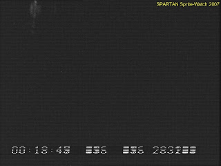


Update (30 June 2008): The exact time intervals of the video frames containing the sprite events are published here. In total four events have been observed.
Thursday, July 19, 2007

Storms tonight 19-20 July

Tonight is the most unstable of the week, followed by cooler air from the ocean without activity for some days.
GFS and MM5 models forecast an MCS starting to develop over the Massif Central, moving into northeastern France around 00 UTC and into Germany. A second MCS may develop not far north of Pic du Midi. Possible problem are the cloud conditions over the cameras. The past two nights were plagued by low/mid level clouds north of the Pyrenees in weak northern flow at low levels and southern flow at mid levels. Today during the afternoon the clouds disappear, but may reappear during the evening as more cold air advects from the northwest in response to the development of low pressure over central France. Later in the night an upper trough creates lift over the Pyrenees with likely increase of middle level and high clouds.
The team from Toulouse will go to Mont Aigoual, which has better chances of clear skies.

Last night a storm system was observed from Pic du Midi and La Molina. Results will be checked today...

Monday, July 16, 2007

Sunday night 15-16 July: 22 sprites from Toulouse


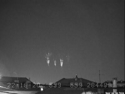
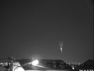
From my balcony in Toulouse 22 sprites were recorded last night over a large thunderstorm complex situated over eastern Bretagne. Between 2133-2231 the storm produced 19 sprites (one every 3 minutes on average), after that a band of clouds silently blocked the view in that direction, while Météorage data showed that many positive lightning strikes still occurred. One very distant sprite was recorded again after one hour, but conditions improved only later (after 0030 UT? absence of distant clouds is very difficult to determine). Without the clouds, at the same rate of sprite production up to a total of 40 sprites might have been observed!
Several events consisted of sprites separated by a relatively long interval of a few hundred milliseconds, occurring over different parts of the MCS.


Forecast update Tuesday 17/7: Storms are likely in the early evening over Massif Central, but when it becomes dark instability disappears fairly quickly... at 21Z when it becomes dark, remaing activity over the Jura, at 00Z farther away...
After 03Z in the early morning instability develops over SW-central France with again chance of storms into the early evening over Massif Central, a bit better than tonight, but the big night is that of Thursday-Friday. So, only marginal possibilities for the coming two nights.